Tag Archives: Friendship

Nile Cruise

After three nights in Luxor our private egyptologist, Safwat, picked us up at the hotel and took us straight out to see the first temple (I’ll list them later for all you amateur archaeologist).  Wowza!

The size and scale is hard to fathom.  As we learned the hieroglyphic stories from day to day – characters and symbols began to repeat themselves and we ourselves felt like pre-school archeologists!

*click on photos to enlarge and tap on the blue words to watch a video of the cruise boat and diesel soaked air

Ra,  Osiris, Isis,  Horus, Anubis, Ramses II, Hatshepsut, Tutankhamun, Nefertiti, Nefertari…..  The stories are fascinating.  The Pharaohs’ and  the Queens’ egos  were humongous and their engineering mind blowing.  The colors are original.  Egypt does not repaint the antiquities.

After the visiting the first temple we checked into our “local” Nile cruise boat – 67 rooms. Over four nights we’d travel from Luxor to Aswan.

Our rooms were large and one up from basic.  Meals were buffets and sufficient.  The gin and tonics – perfect.

What we weren’t prepared for was the vast number of boats.  Oh my! They docked by tying up one boat next to another some six deep.  Unless you were the first boat tied up at shore you had to walk through the first, second, third boat to get to your own.

The air was gross and dirty. The result of 60 plus boats burning diesel fuel.  The way the boats honked at one another and playfully maneuvered around as if playing tag in the toxic cloud was rather amusing.

If you want to book a Nile cruise don’t waste your money paying for a balcony because when you dock next to another boat (which is the majority of time) your view is into the next room.  We went the cheap route and got a sliding glass door which was beautiful when we sailed.  However, we spent more time on deck than in the room.

The pace was wonderful.  Wake up, eat, tour, back to the boat for lunch, chill, back out to tour in the afternoon or evening, back to the boat, cocktails, dinner and bed.

We saw: Karnak, Luxor Temple, Valley of the Kings, Mortuary Temple of  Harshepsut, Colossi of Memnon, Temple of Edfu, Temple of Kom Ombu, The High Dam, Temple of Isis on Philae, and the Unfinished Obelisk.  After all this, in Aswan, we took a small boat ride to bird watch on the cataracts of the Nile and visited a Nubian village where Jonel and I got black henna tattoos.

In Aswan, to unwind and luxuriate we are staying three nights at the historic Old Cataract Hotel (built in 1899) on the bank of the Nile. It is decadent.  We are on our last night right now.

Agatha Christie wrote Death on the Nile while she stayed in her room 2 doors down.  Lady Diana and many dignitaries also spent time here.

We lounged by the pool and walked around town.  We even took part in our own death on the Nile by enjoying McDonald’s on the Nile.  We split a Big Mac!

Mark and Jonel stayed two nights and are now making their way back home first by flying back to Cairo and visiting the Pyramids in Giza.

And we’re off tomorrow for another quick plane ride…

New Delhi, India

Another quick flight to New Delhi, India.

We’re just killing time waiting for friends to meet us in a couple of days.

I had forgotten about all the trees and beautiful parks in New Delhi – so refreshing.  Our hotel was full of Westerners (our first noticeable exposure of this since we left home) and Indians.

New Delhi is the federal capital of India and quite metropolitan.  29,500,000 million people live there.  India is now has more inhabitants than any other country – beating China in 2023.

Last time we checked things out on our own.  This time we hired a local guide to show us around.  The temples/mosques built 500 plus years ago are stunning – a mixture of stone and marble with intricate carvings and honeycomb windows.

We have generally used Delhi in the past to make connections to somewhere else. This time we saw some of its history and chaos. Most of the meaningful historic sites were built during the Mughal or British occupation.

*click on photos to enlarge and click on blue words to see videos

The architecture and attention to detail is unparalleled.  The juxtaposition in a modern city really is jaw dropping.  Out of nowhere stands these structures that have withstood crippling growth and hundreds of years of wear and tear.

We also ventured into Delhi – the old part of town has its own version of utter chaos.  Kinda like Dhaka and Kolkata but unique by its offerings.  It’s wedding central.  Indian weddings last days and are elaborate.  People come from far and wide to buy garments, costumes, decorations and the whole shebang here in these narrow streets.

The fumes from the adjacent spice market brought on uncontrollable coughing.  As we ventured in deeper we had to cover our faces to keep from choking to death. You can hear others in this video.  It felt like a dry form of waterboarding!  Are the shopkeepers immune or dying a slow death?

I felt troubled watching our peddle driven rickshaw driver, no bigger than me.  He either pulled or peddle three adults through the bumpy, overcrowded streets.  Often times having to pull us backwards so the the puzzle pieces of chaos would fit.  He’s in white with a blue collar in some of my pictures.  I snapped away as we tried to maneuver – capturing everyday life.

It was a great detour.  The food was spicy and oh so delicious.  Throughout India we told the restaurant staff to “bring it on” letting them choose our meals.  It’s not for the faint of heart (palate).

Colorful Kolkata (Calcutta), India

A quick flight from Dhaka, Bangladesh and we were in Kolkata (Calcutta), India.  Bangladesh is known as Bengal and Kolkata is known as West Bengal.

Kolkata is the 7th most populated city in India and home to the Mother House aka the Missionaries of Charity’s Motherhouse where Mother Theresa selflessly tended the sick and destitute – her final resting place.  It’s still active carrying on Mother Theresa’s legacy in caring for others.

It’s a stop along the way to our intended destination so we only stayed two nights.

The hotel window overlooked gorgeous fields of crops all in various stages of grown (beyond which the dump burned day and night).  It was such a contrast to the concrete, smoggy city it felt as if we were looking at a painted backdrop.  The taxi driver toured the fields so we could admire the greenery at street level.  He referred to corn stalks as popcorn trees.

Kolkata is the only city in India that has the old classic Ambassador Motors yellow taxi cabs.  They feel solid as tanks.  The cabbies take off in second or third gear rattling our innards while the non- stop horn blowing rattled our brains.

We revisited the places we went 11 years ago to see if we had any brain cells left by recreating the paths we walked to see what had changed. Surprisingly, nothing had changed but the inclusion of cell phones.  Tap on this and that to see video of the Mullick Ghat flower market.

From Bill:  l had a message from his doctor to get an X-ray.  Paige decided that meant now. She called the desk.  The desk called the hotel doctor who drove an hour to see me.  The doctor read the records and wrote a prescription for an X-ray. The doctor drove us downtown to the clinic.  An X-ray was had and read in 20 minutes.  The cost for the X-ray was $7.00 – the cost for the house call and ride was $50.00.

The X-ray was clear and we exchanged a one hundred dollar bill for rupees because the doctor is planning a trip to Hong Kong and wanted a solid currency.

Onward…

Hello Rwanda

Land of one thousand hills.

Boarding time for our RwandAir flight started an hour before the flight.  While we were walking toward the gate from we heard our names over the loud speaker.  A bit strange as it was an hour before the flight. Lo and behold they boarded all of us early and efficiently and the plane departed 40 minutes  before schedule.

We arrived in the dark and what stood out were the lights from hordes of motorcycles resembling dirt bikes buzzing around and waiting in droves for the traffic signal.

*Click photos to enlarge. Click on blue words to see a video.

Rwanda is the third most densely populated country in the world.  A bit smaller than Maryland with approximately 13,700,000 inhabitants.

The country suffered mass genocide in 1994.  It lasted approximately 100 days and a million people were massacred.

Per Britannica (plus my snarky comment):  “The genocide was conceived by extremist elements of Rwanda’s majority Hutu population who planned to kill the minority Tutsi and anyone who opposed those genocidal intentions. It is estimated that some 200,000 Hutu, spurred on by propaganda from various media outlets (imagine that!!!) participated in the genocide. More than 800,000 civilians—primarily Tutsi, but also moderate Hutu—were killed during the campaign. As many as 2,000,000 Rwandans fled the country during or immediately after the genocide.”

Our driver, Kevin, said his family fled to Uganda during this time.  His family repatriated when he was 16.  He’s now 27 years old.   Their community in Uganda consisted of mostly Rwandans.

Rwanda is stunning!  Windy-turny roads, spotless clean, perfect sidewalks (even in mountain areas), no potholes,.  Trees line the streets in the capital.  Beyond is farmland and then jungle.

Poor Kevin must have heard me say “this is so beautiful” a thousand times.  One for each hill.

We spent time in Kigali, the capital.  It was safe to roam around anytime of the day.  Beautiful buildings interspersed with typical unattractive concrete structures.  Because the country is so well cared for those structures do not scream neglect like other third world countries.

We had a driver take us to the huge Kimironko market.  Jammed packed with local fresh food, home goods, hardware and miles of colorful fabric with seamstresses begging to sew you something.  If only we had room in our luggage!

While walking in Nyamirambo, the Muslim neighborhood, we decided to sit at the most popular restaurant for a bite to eat.  Restaurant row was closed to traffic and offered restaurant after restaurant to choose from.  All but one was empty – hawkers tried to lure us in. Of course we choose the restaurant with clientele.  Mucoco must have had 30 employees all wearing t-shirts with their roles embossed on their backs – waiter, cleaner, supervisor, and protocol.  Security people acted like concierges.  A hard working lady adorned in an abaya and hijab also served meals.  Sweat ran down the brow of workers with the rate of hustle serving everyone.  I had the thickest, creamiest, heart attack in a bowl – their version of chicken soup.  It was delicious with local hot garlic chili sauce on it.

** I wrote this a couple days ago and it just now dawned on me that the reason all the restaurants were empty was because it’s Ramadan.  Apparently, our restaurant was full of non-Muslims.

We traveled to Rwanda to see the gorillas.  The drive was three hours long and pure eye candy.  I wish we could have driven slower for all the photo opportunities.  Instead I upped the shutter speed and snapped away.

Not only does Rwanda’s have 1,000 hills it includes mountains and volcanoes.  In this area the three extinct volcanoes range from 12,000 to 15,000 feet. Interestingly when this part of Africa was carved up one volcano went to Uganda, one to the Democratic Republic of the Congo and the other to Rwanda.

The single lane (one in each direction) road was used by huge 18 wheelers, cars, trucks, motorcyclists, bicyclists (ridden and used to carry heavy goods), walkers (carrying their wares on their shoulders or head), little children, goats, sheep and cows.  The roads are paved and in perfect shape.   Many areas had sidewalks, retaining walls, and street lights.

Did I mention how beautiful Rwanda is?

There’s not much wasted space in the country. Tiered hills with rich, dark, volcanic soil are either full of crops or ready for the next planting – weedy – where some men but mostly woman bent over 90 degrees hoeing. Corn season is over and hangs drying in large open air buildings.  Banana plants are prolific and potato plants are growing at various stages.

Homes range from concrete to mud huts and there are no signs of trash anywhere.

We spent the night before our trek in the mountains.  I chose a budget lodge .  The cost of the park permit to see the gorillas was $1500.00 each so we conserved.  It was great.  It reminded us so much of places we have stayed in China.

We were greeted with a glass of fresh squeezed juice and two plates of snacks and fruit.  We were handed a typed sheet of paper and a pen to choose what we wanted for dinner.  There were two choices plus lots of side dishes.

The room  was not attached to the lobby/restaurant.  It was huge (the whole place bigger than our tiny house) and sparse with stone floors and concrete walls surrounded by jungle – which equated to no sunlight which equaled a frigid room.  Lucky, there was a plug-in heater and closing the door to the cavernous bathroom helped the heater do its thing.  The innkeeper said it would take a minute or so for the water to warm in the shower.  That didn’t matter to us. There was no way we were getting naked in that cold room plus the towels were still damp from being laundered.  Bill and I hopped under the covers until dinner time.

We learned we were the only guests.  A coal burning pottery stove was placed beside our table and a candle provided ambience.   The dinner portion was fit for a king and the food was delicious.  We were embarrassed to hand back our plates with only a portion of the food eaten.

By the time we returned to our room the heater had made the space toasty and the staff had put hot water bottles between our sheets.

Up at 5:30 for our 6:00 pickup to head to the gorillas.

To be continued….

With Sadness – Walvis Bay, Namibia and Beyond

We didn’t fall off the edge of the earth.  I stopped the blog as it seems so inconsequential compared to the devastating news that my stepdad passed away.

We (and the doctors) thought beyond hope that he would improve once he got “home”.   

Michael’s decline happened quickly and thank goodness we were in port when we got the news. With two hours notice we booked flights, packed and jumped ship. Unfortunately, by the time we arrived God had called Michael to His home.

We flew out of Walvis Bay, Namibia after a day of touring.

Situated just north of the Tropic of Capricorn.  It’s the second largest city in Namibia and was once part of South Africa – gaining their independence in 1990.

It is the driest country in Sub-Saharan Africa and considered to have the oldest desert (called the Namib Desert) in the world.  It was tribal until Germany colonized it in 1884.

Their primary language is English however everyone seemed to be speaking one of their 15 other languages.  89% of the population are Christian.

The town is clumped around the port and beyond that is endless sand and mirages.  It was remarkably tidy – zero graffiti.

*click on photos to enlarge

We went on a 4 wheel drive excursion to see “the desert”.   I had seen photos of The Namib Desert where humongous sand dunes kissed the shore of the ocean.  This is what I envisioned seeing.  Unfortunately, it was too far away.  With ship board excursion credits we opted for a desert 4 wheel drive experience.  The day was beautiful and it was just us and another couple – perfect size.  It turned out to be the “Chamber of Commerce” tour.  A drive to the Moon Landscape (similar to the Badlands in South Dakota) on graded dirt roads where all the 4×4’s stopped with a break to see the Welwitschia plant – referred to as a “living fossil”.  It is found growing in the nothingness of the Namib Desert and Southern Angola. Some plants are said to be between 1000 and 1500 years old.

Walvis Bay is home to gazillions of flamingos – white and pink.

It was fun being off the boat.

Namibia – the vast nothingness of sand was overwhelming as we glanced out the plane’s window on our way to Cape Town for our long journey to the States.  The wind etched windrow upon windrow patterns in the sand like waves in the sea.  Fog laid low over Atlantic Ocean greeting the desert shore.

We stayed over in Cape Town before the next leg of the flight back to Southern California – 37 hours from door to door.

Now we’re with mom.

Next year we’ll finish our trip…

May the spirit of Christmas shine in your heart and light your path.

Sekondi-Takoradi, Ghana

Sekondi-Takoradi, Ghana. The capital of the Western Region.  Referred to as twin cities. 

Tall commercial buildings pierce the horizon while dilapidated colonial buildings dot the countryside.  

Gridlock traffic wreaked havoc to any sort of flow.  It took about 45 minutes to move out of the hustle and bustle as we maneuvered our way to a coastal fishing village.  The blurry photos are from the bus window – click photos to enlarge.  

The chiefs and village elders spoke to a crowd of cruisers while Bill and I chose to roam and visit with the locals.

Living conditions were rudimentary at best.  I needed to use the bathroom and was invited to a back corner walled area that was about 3’ x 3’ with a wet mosaic tile floor.  The floor barely slanted towards the edge of the wooden structure.  That’s it.  No running water, no drain, no trash – only two small buckets.  Imagine my confusion. Bucket? Floor? Bucket? Floor?

A fellow female cruiser approached me later and asked floor or bucket? I asked her without answering and she said she was told floor….  Ain’t life grand?

A few spoke English so we were able to converse.  We talked politics a bit.  Their election is coming up in a couple days and their “biggest” issue is compulsory schooling for children.  Some want it and others think it’s a waste.  We talked with two who had differing opinions.

The village children were delightful.  I taught them to fist bump with an explosion.  The first child warily and bravely humored me and then one child after another lined up to give it a whirl.  After a few minutes they were so animated that they acted like they were falling backwards with each explosion. Their smiles and laughter were contagious. 

A couple moms and big sisters asked to have their photos taken and I received a marriage proposal from a giddy young man.  HA!

In this particular village the fish are salted and smoked. 

The rural commercial fishing area was lined with long wooden boats, some with piles of knotted up used nets stacked high.  Left over piles lay on the sand waiting to entangle and cling to the shoes of daydreamers. 

People were hard at work weaving and stacking nets, cleaning fish, selling/buying goods and washing clothing.  A fishing expedition can last from one to seven days.  From here it’s not hard to imagine that the most common occupation in Ghana is fishing. 

My light skin and white hair had some stop me to say how beautiful I was.  Which, at my age and full of wrinkles felt like at any moment a camera crew would jump out to say “You’re on Candid Camera”. 

During such an event one woman, with her wares on top of her head, took both her hands and stroked my hair over and over – smiling from ear to ear.  It was so awkward but I reminded myself about curiosity and humanity.  We who can step out of our comfort zones get to actually embrace one another.

It dawned on me that only one boat had a shade canopy with a single man weaving under it. His partner sat four feet away in the sun, with a towel on his head, dripping sweat. In my best sign language I complemented the smart guy and tried to ask the other man why he was in the sun.  Encouraged by the complement, the shade man motioned for me to walk around the boat to his side to watch him weave. 

A school grounds visit was spectacular.  I can’t even express the sheer joy that I experienced.  There were hundreds of kids from all ages.

A group of mostly elementary kids gathered and I whipped out my phone with my FatBooth app open and ready.  I took a photo of a child and then asked them to wait one moment while my phone munched away and came back with a photo of her with a “fat face”.  They roared – laughing and falling all over one another – each egging the next on to see what they’d look like.

One of the girls asked me to play music so I put on Katy Perry’s “Firework” song and the dance party began.

Before we sadly had to depart I asked them to all jump for a photograph.  Craziness ensued. What a blast.  I could have stayed there all day.

My heart was full.  It was a good day!

Banjul, The Gambia

For all you prayer warriors out there please add my stepfather, Michael, to your prayers.  He can use a healing hand.

The city Banjul is located on St Mary’s Island (Banjul Island), where the Gambia River enters the Atlantic Ocean.

The Gambia (formerly know as Gambia) is Africa’s smallest country in the continent and is nestled in by Senegal.  The river runs the entire length of the country. English is their primary language. 
For those who watched Roots it’s Kunta Kinte‘s ancestoral home. Two-thirds of the population is under the age of 30.

Their economy is mostly dependent on peanut (groundnut) production and export.

Click on photos to enlarge.

We took a bus ride into town.   Trash was everywhere and the air thick with dust from dirt roads.  It is a Muslim country and being respectful I was completely covered, from wrists to shins, in the 94 degree temperature.

The people we encountered were super sweet and friendly.  A couple woman even asked me to take their photos.

Back in Suriname

Back to Paramaribo, Suriname to finish what we started.  We met a great group of people on the border crossing boat who all spoke English.  A lady who currently lives in French Guiana having escaped Vietnam in 1975, a man from Laos and another from Cambodia all going to Suriname for the Easter weekend.

Like the masochists we are we decided to walk in the heat of the day to the Arya Diwaker Hindu Temple – a mere 5 plus miles. 


We passed through the bustling Central Market where herbs and dried greens were stacked high and sold for medicinal purposes.

Having been warned that the women shopkeepers didn’t like their photographs taken, I took heed and asked a gal for permission to take photos of her goods, promising to exclude her.  She kindly said yes and oh what a stir that caused.  Another shopkeeper came running up to cuss me out.  In my best English I told her to take it up with the person who gave me permission.  Bam.

We took a boat trip up the Suriname and Commewinje Rivers that led us to Nieuw-Amsterdam, Rust-Werk, Johan-Margaretha and Plantage Frederiksdorp.  Like visiting the landlocked country of Eswatini (Swaziland) last year – it felt a bit like forced tourism.  I’ll be kind and just say…

We enjoyed being on the water. The breeze from the boat’s movement cooled the pools of sweat on our bodies.  We played Where’s Waldo with the frolicking dolphins that live in the brackish waters.  Our boat weaved and bobbed in the swift river current.  It was the highlight of the day.

Plantage Frederiksdorp looked charming on the internet.  It’s an old plantation turned hotel/resort.  Our last stop.  A two hour stop!  UGH! Two hours.  It was suggested that we relax by the pool.  Apparently good and relaxing for people with no sense of smell!! The moldy, black, stagnant water sitting in the canals around the pool and bar reeked so badly that I had to hold my breath and briskly walk back towards the entrance to get some relief.  Poor Bill was also gagging but wondered where the fire was.  I didn’t want to have to take a breath until I was clear of the area.   Under the shade of a big tree we did relax and read.

Below the surface and unseen, drug and human trafficking are evil problem in these adjoining countries – a gateway to the United States and Europe.

Our take away from Suriname is the people.  Very warm and friendly.  We loved that, from our point of view, many cultures communed without animosity.   Our boat captain said it still a work in progress…

We’re super glad that we explored this part of South America.  It’s not on the bucket list for most Americans but we’re honored for having been the few.

From Bill:  Guyana in indigenous lingo means “Land of water” and included two additional land areas north and south prior to colonization. There is much water. Basically one paved road runs from Venezuela to Brazil on the coast where more than 50% of each country’s population lives.

The populations are very diverse, mostly from importing slaves, or post-slavery, “indentured workers” from Java, India and somehow, China. Its a bit strange to see some of these nationalities on horseback and tractors, or to hear unusual languages spoken by differing nationalities (e.g. Chinese speaking  French). However, the dominant nationality is African, presumably because there were more slaves than slave masters.

Cayenne and Kourou, French Guiana

Back to Cayenne to our little apartment.  It was actually great if we only could have moved it to a different location.

*click on photos to enlarge

French Guiana has a strong Creole culture.  They speak French and Creole – very few speak English.  It’s part of France, henceforth the E.U. and uses the Euro.  The locals feel like France’s ugly stepchild and are quite bitter about France taking the gold and oil profit from the region and sending it back to France.

Per Wikipedia – The first French establishment was recorded in 1503, but they did not establish a durable presence until colonists founded Cayenne in 1643, were forced to leave by Amerindian attacks and then finally established a permanent settlement in 1664. They lost it again to the Dutch, English and Anglo-Portuguese until 1814 when it returned to French control.

After France ceded Louisiana to the United States in 1804, it developed Guiana as a penal colony, establishing a network of camps and penitentiaries along the coast where prisoners from Metropolitan France were sentenced to forced labour…. Approximately 56,000 prisoners were sent to Devil’s Island.

Per Britannica:  In 1852 Napolean III decreed that convicts with sentences of more than seven years were to be sent to French Guiana, and Cayenne became known as the city of the condemned. The prisons were closed in 1945.

Cayenne is hilly and charming as heck with old French colonial wooden houses and swaying palm trees resting between the Cayenne and Mabury rivers.

Worse than the large wide river in Oiapoque the narrow rivers near Cayenne completely stop navigation at low tide.  The boats look like shipwrecks from a storm.  I can feel the hurl rising in my throat when our cabbie talks about the local fresh fish sold in the streets of Cayenne.

The ruins of the hilltop Fort Cépérou allow for beautiful long views of the city, river and beyond.

An hour west of Cayenne and heading back towards Suriname is the town of Kourou.  Our next stop for a couple days.

Kourou is home to the home of the Guiana Space Center.   The main spaceport of France and the European Space Agency. 

According to space.com:  The French government began launching satellites there in 1964, and offered to share it with the European Space Agency when the latter was created in 1975.  ESA contributes two-thirds of the spaceport’s annual budget every year. The spaceport has also been used for launches for the United States, Japan, Canada, India and Brazil, among other countries.

Like many launch sites worldwide, Kourou is located near the equator. Its latitude is 5 degrees 3 minutes north, ESA says, which makes it a good location to launch missions that will operate at or near the equator. That’s because the Earth’s rotation acts as an extra source of propulsion for the rocket as it brings the satellite into space, saving fuel and money. It also allows for satellites to be heavier since less fuel is required.

Off the coast of Kourou is the famous Devils’ Island part of the three Îles du Salut, or the Salvation Islands known from 1852 to 1953  as “the Green Hell”.   A penal colony housed more than 80,000 men (only 30,000 survived).  The movie starring Steve McQueen tells the story of Henri Charrière, the author of Papillon, and his efforts to get away.

L’ile St. Joseph and Ile Royal are open to the public.  An hour and a half boat ride from Kourou.  Devil’s Island is permanently closed.   

The coconut population – in the palms and on the ground was innumerable.  At a quick glance the faded piles of coconuts looked like skulls. The islands were stunning, a stark contrast to the horrors of the past.

It reminded me of Alcatraz in San Francisco, California and Robben Island in South Africa.

It was hot and humid!

After French Guiana we headed back to Suriname to spend a bit more time.  I’m not a big fan of backtracking but flying out of French Guiana is insane – flights are only to Paris and Martinique.

Oiapoque, Brazil

A shared van showed up right on time.  It’s quite a remarkable system that we’ve experienced in Guyana, Suriname and now French Guiana.  These drivers pick up passengers at their homes, hotels, etc and drop them back off as well – there’s no main terminal like a bus company.

We rode from Cayenne to St. George’s (French border).  The only other passenger was a Polish guy who spoke no English but recited all the countries where he has traveled in the world.  The list was exceptionally long.  He only possessed a tiny, half full backpack that could hardly hold another set of clothes his body odor confirming such a thought.

The shoulder-less roads were windy and the ground undulating with the rise and fall of the jungle.  Wild banana and papaya  trees lined the road, as well as an occasional rusted, burnt out car with its tires missing.  Do they not have means to remove them or this is a public service announcement?  It did give me pause nonetheless.

Our French and Portuguese speaking driver whizzed along breaking for the one lane bridges that sprang up forcing the cooperation of drivers in both directions.

At the border we thought we’d cross the Oyapock River by boat but we signaled the need for a passport stamp, confusing the driver.  He drove us to the police station just before the entrance of the Franco-Brazilian Binational Bridge.

This bridge was finished in 2011 but sat unused for 6 years, citing problems on the Brazilian side.  It was finally opened due to pressure from French Guiana.  It’s the first bridge between French Guiana and a neighboring country.  Since Brazil has not built a customs facility the bridge is only for personal vehicles- no commerce.  It’s only open for 4  hours in the morning and 4 hours in the afternoon and closed on weekends.

The police at the French Guiana border waved his hand in the air when he realized we were only going into Brazil for hours, signaling that we didn’t need a passport stamp.  He kindly called us a taxi and we were on our way.

The immigration office on the Brazilian side was in downtown Oiapoque.  When we explained that we’d only be there for hours the English speaking immigration officer laughed and said he’d stamp our passport as a souvenir.

With his suggestion for the best restaurant we parted ways with our Polish world traveling friend and headed for lunch.  The sleepy little town didn’t offer much so we filled our bellies and strolled.

Fishermen in all these countries net fish from boats on the big rivers and ocean. Some hang their nets in the river and check them every 5-6 hours. Some boats go to sea for 14 days and only have ice to preserve their catch – no refrigeration.

Oiapoque sits on the edge of the Amazon basin, and looks like a thousand other small river towns all the west to Peru – one story wooden buildings, dusty dirt streets, mostly indigenous people, folksy crafts for sale and all the action is along the river

The low tide renders the boats useless in the brackish waters at the river’s edge.  Several fishermen were working on their nets while others were just hanging out.

Per Wikipedia: At the beginning of the 20th century, the village of Oiapoque hosted a political and criminal concentration camp called Clevelândia. In 1922 an agricultural outpost called the Núcleo Colonial Cleveland was transformed into a camp. Many Brazilian anarchist militants were sentenced to hard labour here. Of the 946 prisoners interned at Clevelândia between 1924 and 1927, 491 died. Many of the survivors returned to São Paulo and Rio de Janeiro sickened with malaria

Leaving Oiapoque we crossed the border at the river’s edge since immigration wasn’t an issue.  One of the passengers in our boat was a local English speaking lawyer/musician who relayed stories about the area.

Silver dollar pancake sized raindrops pelted us for a time on our ride back to Cayenne – alternating between deluges and sunshine.

Sawubona from Johannesburg

It was a balmy 83 degrees when we landed. Paradise.

The evening brought a stunning show of thunder, lightning and heavy rains.

Delta Airlines out of Atlanta got us to Johannesburg in 15 hours. It was our first lengthy international flight on a domestic carrier. We were pleased.

The drive from the airport to the hotel was lined with big beautiful homes behind tall concrete fences with 18” of electrical wiring at the top.

Unbeknownst to us our hotel was located in Melrose Arch – a new walkable urban development that has hotels, shops, restaurants/bars and condo living. It’s all completely fenced with lots of security guards wandering about. It didn’t feel like the “real” Johannesburg but allowed us to walk around feeling safer.  We ventured out to explore during the day.

Unfortunately my camera stayed in the hotel room as we explored the city. I got disciplined twice by a hotel worker in Rosebank for having my cellphone out. The second warning came with his head turning tisk tisk for being so careless. Clearly he didn’t understand that I needed to use Uber.

Like all big cities around the world Johannesburg aka Joburg, Jozi and the City of Gold is bustling. Sidewalks are lined with people on the move and gridlock traffic is a nuisance.

It’s a new city – started only a 137 years ago by the discovery of gold. Once the top gold producer in the world and currently it holds the honor of having the deepest gold mine extending 2.5 miles underground. Some sister love to our home state of Nevada which produces 78% of all gold mined in the United States.

Joburg also has the honor of having the largest “urban” man made forest in the world with over 10 million trees! It’s remarkable.

Strange are the number of abandoned buildings. We were told that redevelopment plans were halted by covid but it looks like any hope of anything stopped long ago.

Mostly abandoned buildings.

Nelson Mandela is revered by the world but his presence here was palpable. We toured his home in Soweto. Bullet holes pock mark the siding and the remants of an interior wall built by Winnie to shield their children speak of the dangerous time.

There is so much to learn and absorb in this place so terribly victimized by apartheid, poverty and crime. It is all very heart wrenching.

Exploring lends to curiosity, which lends to investigating, which lends to learning, which broadens my knowledge.

The privilege of meeting locals makes it all so worthwhile.

Zanzibar – Stone Town

Doesn’t that sound so sexy and exciting? Zanzibar.

After a two hour ferry ride across the Indian Ocean heading due East we docked in another UNESCO World Heritage site called Stone Town.

From the UNESCO website: The buildings of the Stone Town, executed principally in coralline ragstone and mangrove timber, set in a thick lime mortar and then plastered and lime-washed, reflect a complex fusion of Swahili, Indian, Arab and European influences in building traditions and town planning. The two storey houses with long narrow rooms disposed round an open courtyard, reached through a narrow corridor, are distinguished externally by elaborately carved double ‘Zanzibar’ doors, and some by wide vernadahs, and by richly decorated interiors. Together with, the simple ground floor Swahili houses and the narrow façade Indian shops along “bazaar” streets constructed around a commercial space “duka”.

The old carved doors in Lamu and Shella originated in Zanzibar. They are truly a work of art and the focal point of most facades.

Click to enlarge photos…

We stayed in an old converted mansion. Much like a Mexican hacienda but probably Portuguese. The decor is old, stylish and ornate. It felt like we had stepped back in time.

Still sick and dragging. We managed to explore everything Old Town had to offer. We’d walk and walk and then I’d collapse in bed.

The streets in the old portion of town were narrow and filled with cars and motorcycles making passage on foot quite dangerous.

Every 15 seconds we were asked if we wanted a taxi ride or to visit a shop. Zanzibar is still reeling from the shutdown – there are 30 parked taxis for every person visiting. 

Once off the beaten path we were able to avoid being on alert and were able to experience the quiet more “normal” non-tourist life.

Strolling through markets can be enlightening. The colors and activity are invigorating. It’s mind-blogging to see how meat and fish sit out unrefrigerated. It’s always an opportunity for me to explain (haha – often with hand signals) that our son does the same job in America (albeit wayyy different). This precipitates smiles and invitations for me to take photos.

A dark side to Zanzibar was the slave trade market that started in 1811. The world’s last open slave market. Over the course of 60 years one million enslaved were traded here. Taken from Central and East Africa and brought across the Indian Ocean to Stone Town.  Some slaves remained in Zanzibar to work in the plantations and the remaining were sent overseas to the Persian Gulf and Asia.  David Livingston in 1857 made an appeal to Cambridge and Oxford Universities to end the slave trade in Africa. By decree of the Sultan of Zanzibar slave trade ended in 1873.  In 1874 the Cathedral Church of Christ was built in its place. The haunting Slave Market Memorial was created in 1998 by Clara Sornas of Scandinavia.  This day a class of high schoolers were learning about this site.

Side note:  Tanzania has two presidents.  One for mainland Tanzania and one for Zanzibar.  When we entered Zanzibar we went through customs even though technically it is Tanzania.  They went from a Covid denying President (on the mainland who died during the pandemic) to new one (five months in office) who is trying to change the perception and response to Covid.  The only people with masks on are hotel workers.  As I am writing this and doing research online the first (not the “first” but that’s his title) VP of Zanzibar died today of Covid.  The USA State Department issued warning for its citizens not travel to Tanzania because they have not reported their Covid cases.  I should also add that no one on the island of Lamu in Kenya wore face masks.  It was strange, a bit unnerving but in the same breath fun to see people being normal.

Off to the beach…


The Day After Finishing the Via Francigena

Don’t cry because it’s over. Smile because it happened. ~ Dr. Seuss

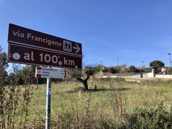
Today we went the office of the “Opera Romana Pellegrinaggi” in St. Peter’s Square for our Testimoniums (certificate for completing at least the last 100km of the Via). The pilgrims who started Canterbury get the same document.It’s just like the Camino de Santiago. Walking the last 100km (62 miles) gets you a Compostela.Chappy, Bill and I weighed ourselves. Bill was the winner at losing the most.Bill and I hoofed it to our new luxurious hotel where we will veg for the next three nights. Soft sheets, a bathtub and a huge TV with English channels. Not sure if we’ll get out of bed tomorrow. Chappy, Darrell and Roxanne stopped by to check out our new digs and we all walked to see the Trevi Fountain (along with 1,000,000 other people) to hug it out and say goodbye.Chappy is heading home tomorrow and Darrell and Roxanne are off to discover Italy by train.

Roxanne’s post and photos:

Completing our pilgrimage to Rome and receiving our Via Francigena Testamonium today means farewell to the Fab Five and hello to the positive memories we’ll share with each other back home in Nevada. Thanks Paige for sharing your blog with our loved ones! Luxury is clean cloths!Well done Pilgrims!

Day 39 the Final Day on the Via Francigena

La Storta to Rome – Sunday October 14th (Preston’s birthday – love you honey) – 13.3 miles in 7 hours 14 minutes.

The Fab Five made to Rome all in one piece and blister free.

What an experience! We’re so appreciative of our health, the ability to perform such a task and friendship.

Our walk today was…. well… you decide…. (photos are in order).
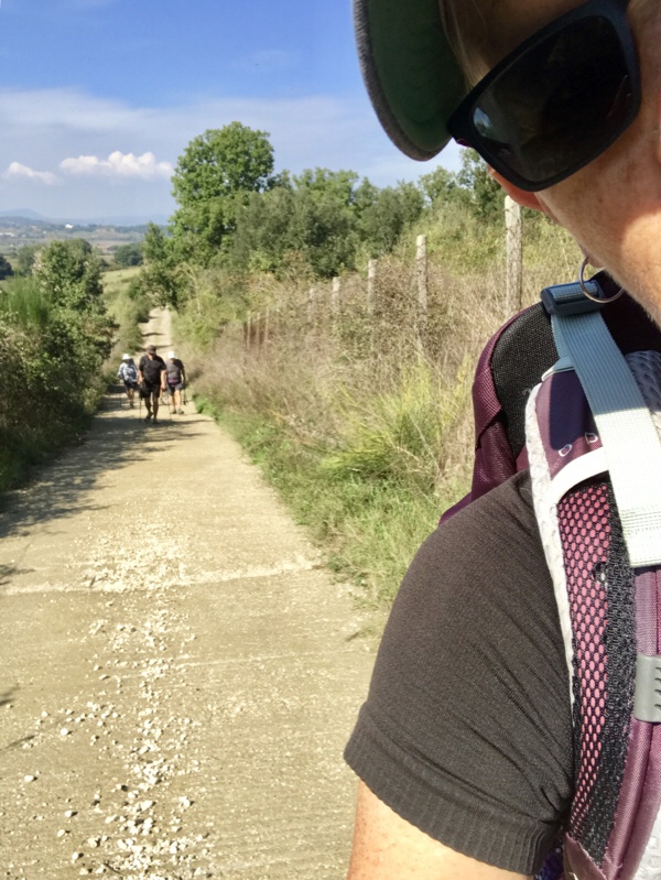
Obstacles to climb over…
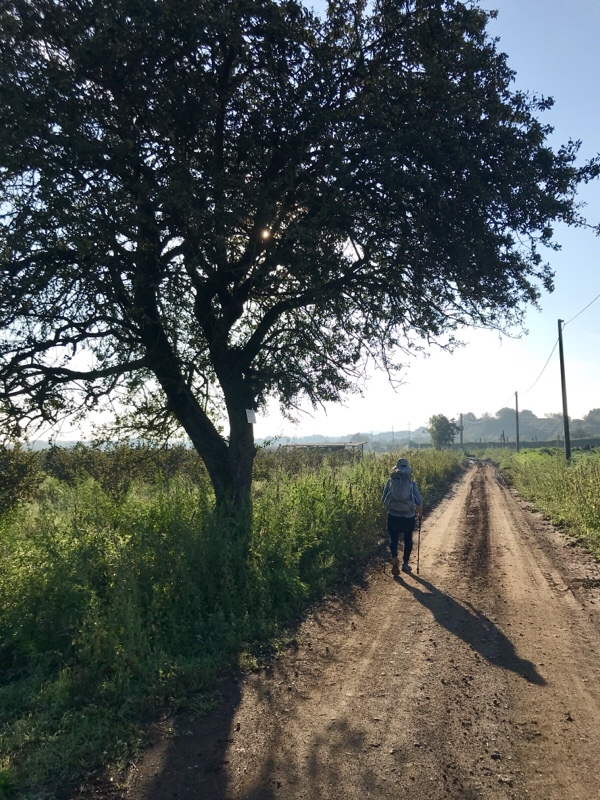
95% was on pavement.We’re staying at the Vatican Garden Inn. Don’t stay here!

Roxanne’s post and photos:

The Fab Five have landed!
St. Peter’s Square, Rome.

Day 38 on the Via Francigena

Campagnano to La Storta – Saturday October 13th – 14.4 miles in 6 hours 45 minutes – climbing 1443 feet.

You have brains in your head. You have feet in your shoes. You can steer yourself any direction you choose. You’re on your own (and with friends). And you know what you know. And you are the one who decided where to go (Rome). Dr. Seuss

It feels so good knowing that the Fab Five will be walking into Rome tomorrow. We’re smelling the barn. I think we’d gallop if we had the energy!

Hotel Cassia is where we will rest our heads tonight. Twin beds in a private room. Clean.

It isn’t the mountain ahead that wears you out; it’s the grain of sand in your shoe. Robert W. Service

Roxanne’s post and photos:

Ladies and gentlemen, The Fab Five are now on final approach into Rome. Walked from Campagnano di Roma to La Storta. This last stage before Rome took us through pastureland, shady woodlands, 6th century BC Etruscan burial sites, a waterfall and an ancient water mill. Gluten free eating is easy in Italy!
There’s an APP called AIC (Italian Celiac Association) that shows where Gluten free meals and products are sold and those options are everywhere in Italy even in tiny villages.

Day 37 on the Via Francigena

Sutri to Campagnano – Friday October 12th – 13.1 miles in 6:10 climbing 897 feet. 
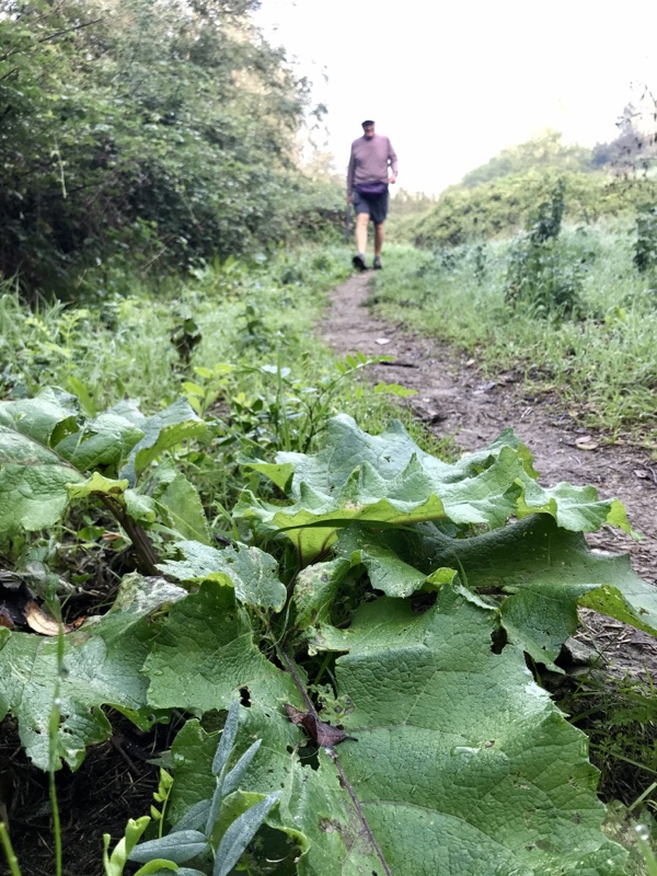
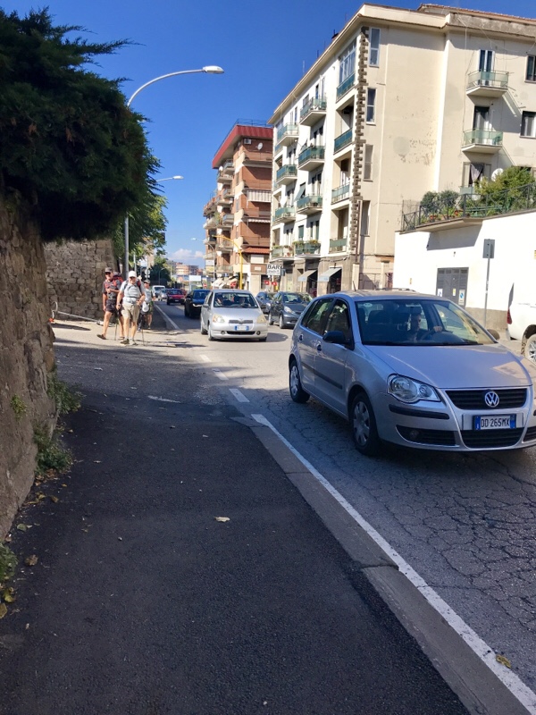
Shorter is not always better. To save 3.5 miles we walked along loud busy roads. My umbrella warded off evil cars until we safely made it to a quite path that lead us into town.We’re staying at  Hotel Ristorante Benigni.

Two more days until Rome.

Seven more days until we meet the new love in our lives – Graciella Faye.

Roxanne’s post and photos:

Leaving our Sutri apartment.Roman Amphitheater from 
1st-2nd century BC. Which way?After walking to Campagnano di Roma, we sat down to a fine late lunch and reunited with our fellow pilgrim from Denmark. 

Day 36 on the Via Francigena

Vertalla to Sutri – Thursday October 11th – 16.8 miles in 8:40 and we climbed 1375 feetHard to believe that a day that starts with a rainbow turns out to be nuts literally and figuratively.If we weren’t walking through a slippery, muddy rain forest with lots of obstacles we were walking thru miles of nut trees.Bill twisted a muscle in his back so we hired Bags-Free to transport his pack from hotel to hotel. Chappy quickly decided that was a great idea and signed up too. I have to admit I loaded Bill’s pack with my clothes so that I could carry a lighter load.There were spills and thrills today – not all for the faint of heart.

Darrell – Don’t drink the water here or you’ll get Giardino.

We’re staying at B&B Caseta di Vicolo Corto. The beds are so comfy and the place is beautiful. We actually have our own apartment and it’s new, clean and fabulous.

Roxanne’s post and photos:

Walked from Viterbo to Sutri.Snack at the base of a Roman tomb near Capranica.

Day 35 on the Via Francigena

Viterbo to Vertalla – Wednesday October 10th – 11.2 miles in 6 hours only climbing 874 feet.
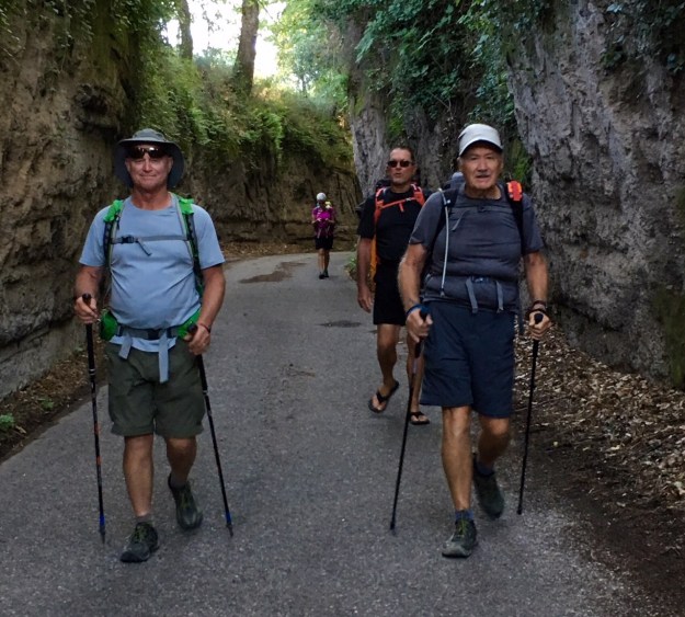
Fun day walking through an Etruscan Via Cava which I’ll translate as a road with tall lava walls.
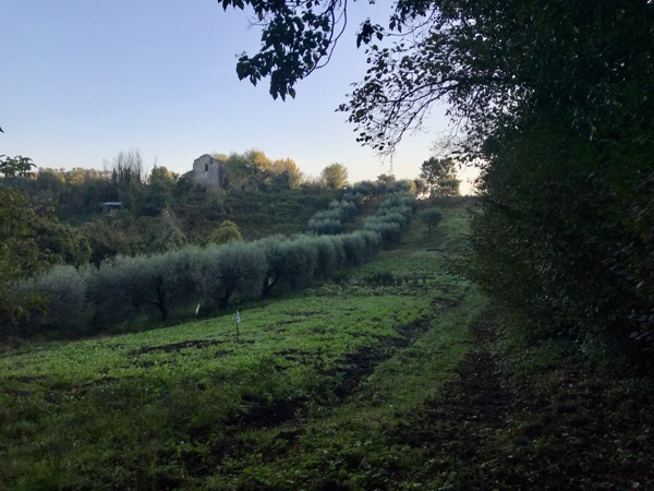
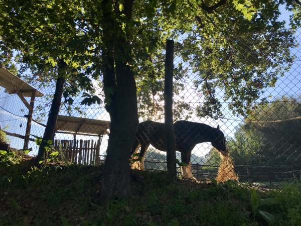
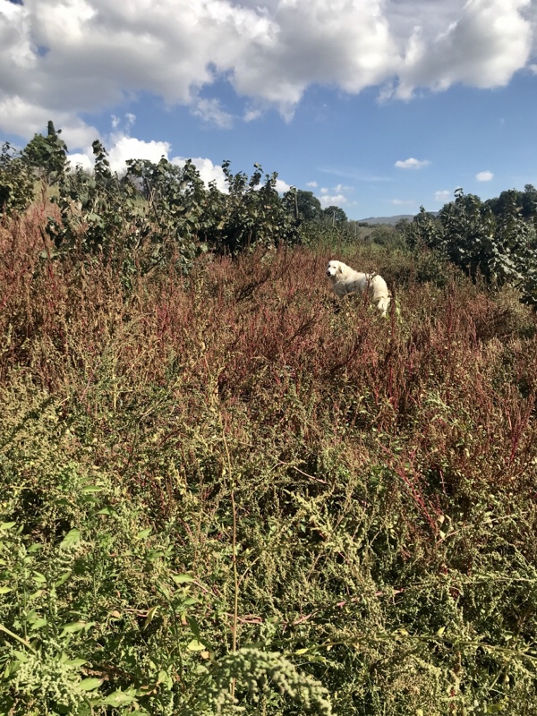
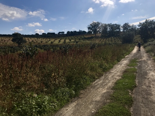
Followed by lush farm land – a Clydesdale horse and super friendly donkey – nut trees and olive production.

We’re staying at Alberto da Benedetta. We’re happy to announce that we’ve ditched Ostellos (hostels). We’ve opted for more restful sleep.

Four more days to Rome!

Roxanne’s post and photos:

Humane Italy ♥️Walked from Viterbo to Vetralla.Gear off.Fellow German flip flop pilgrim.BreakfastOlive harvest comb.Picnic lunch.

Day 34 on the Via Francigena

Montefiascone to Viterbo – Tuesday October 9th – 12 miles in 6 hoursWe said goodbye to Lake Bolsena. The largest volcanic lake in Europe and considered to be the belly button of Italy.Bill and I had an off day. Our packs didn’t set well. We walked down from Montefiascone and then became weary with the level shadeless terrain. Just one of those days…Highlight! Roman road dating back to 150 BC.Tonight we are staying at the Palazzo Riario. The gentleman that checked us in ran over to meet us at the hotel in his chef’s clothing. Often times hotels are not manned 24 hours a day. After checking in we promptly dumped our packs and followed him to his restaurant. It was fantastic!Baby alert hence grandparent alert! Congratulations to Troy and Yessmy. Late last night Graciella Faye was born. She is absolutely beautiful and we can’t wait to meet her. Yay! Bursting with love.

Roxanne’s post and photos:

“Coregone” fish caught out of Lake Bolsena. 
The Fab Five walked out of Montefiascone and walked to Viterbo the center of Italy’s military aviation. Roman RoadMorning SnackBelt Modification Lunch breakBaby Announcement Grocery store bulk wine

Day 33 on the Via Francigena

Bolsena to Montefiascone – Monday October 8th – 12 miles in 6:09 hours – climbing 2079 feet

Lago Bolsena the largest volcanic lake in Europe and the belly button of Italy.

Another beautiful day. Today – my easiest. However, we all swatted swarms of bugs throughout the walk. We’re not sure if there was a hatching after the rain or what….

We are within 100 kilometers of Rome – which is a big deal. Within a hour and a half period we saw 3 different signs that said we were within 100 kilometers to Rome. What’s up with that???

Here’s what we saw between signs…

We’re staying at the Hotel Urbano V. Super place! Bar, terrace and sunny places to dry our clothes.Roxanne’s post and photos:

South end of Lake BolsenaOur Pilgrim passports daily stamp

Made in Italy